
Natural Hazard Research Group
•Professor (International Research Institute of Disaster Science) Shinji Toda,
specializing in studies of active faults, inland earthquakes, seismicity and earthquake probability
•Associate Professor (International Research Institute of Disaster Science) Daisuke Sugawara,
specializing in sedimentology, numerical modeling and sediment transport
•Associate Professor (International Research Institute of Disaster Science) Yo Fukushima,
specializing in studies of crustal deformation, geodesy, earthquakes, volcanoes and modeling
•Assistant Professor (International Research Institute of Disaster Science) Takashi Ishizawa,
specializing in sedimentology, Quaternary research and geochronology
•Assistant Professor (International Research Institute of Disaster Science) Takayuki Takahashi,
specializing in geomorphology, Quaternary geoscience, tephrochronology, sedimentology and fluvial hazards
Marine terraces as a useful indicator for long-term crustal movement
To understand the repetitive cycle of earthquakes requires knowledge of crustal movement on a scale of thousands to hundreds of thousands of years. The distribution and age of marine terraces and buried landforms help to establish the record of crustal movements. 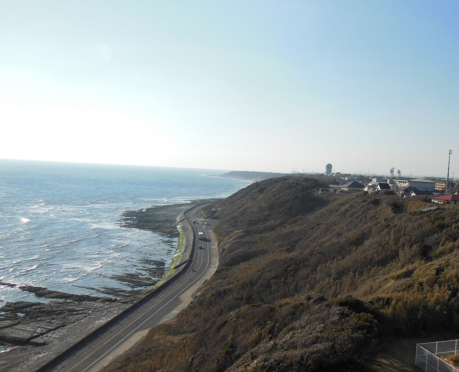 We are working on the reconstruction of long-term crustal deformation in coastal areas of the subduction zone in Japan and overseas, including the Pacific coast of the Tohoku region. In addition, we are trying to understand the strain accumulation processes associated with large earthquakes and the mechanism of earthquake occurrence by comparison with geodetic records on a scale of several decades to 100 years.
We are working on the reconstruction of long-term crustal deformation in coastal areas of the subduction zone in Japan and overseas, including the Pacific coast of the Tohoku region. In addition, we are trying to understand the strain accumulation processes associated with large earthquakes and the mechanism of earthquake occurrence by comparison with geodetic records on a scale of several decades to 100 years.
Revealing paleo-earthquake histories by researching active faults
Large inland earthquakes greater than magnitude 7 are caused by the movement of active faults. More than 2,000 active faults have been found in the Japanese archipelago. We are investigating not only their distributions 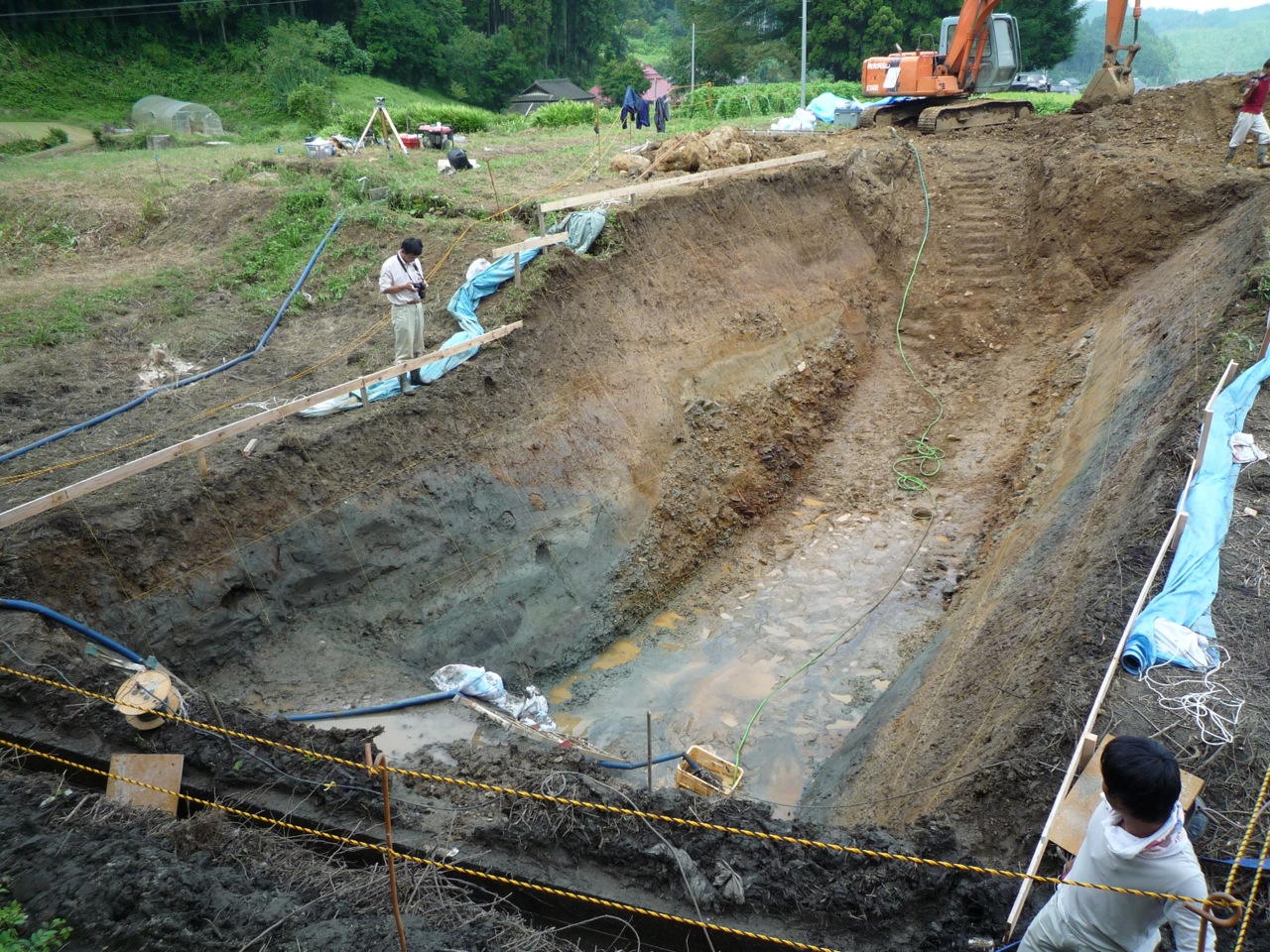 but also the ages and slips of prehistoric earthquakes (paleo-earthquakes), and estimating the probabilities of future inland earthquakes by observing recent sediments exposed on trench walls across major active faults. The photograph shows the excavation survey in Fukushima Prefecture of the Idosawa and Yunodake faults that ruptured in 2011 CE (Fukushima-ken Hamadori earthquake) and 13,00017,000 years ago.
but also the ages and slips of prehistoric earthquakes (paleo-earthquakes), and estimating the probabilities of future inland earthquakes by observing recent sediments exposed on trench walls across major active faults. The photograph shows the excavation survey in Fukushima Prefecture of the Idosawa and Yunodake faults that ruptured in 2011 CE (Fukushima-ken Hamadori earthquake) and 13,00017,000 years ago.
Paleo-tsunami research using tsunami deposits and numerical simulations
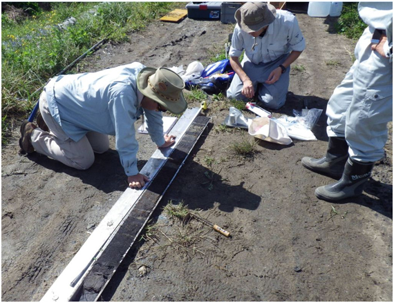 Infrequent catastrophic hazards can be assessed using sedimentary data from tsunami deposits, which are typically preserved in coastal sedimentary sequences. The numerical modeling of past tsunamis improves our understanding of mechanisms which generate low-frequency large-scale earthquakes and tsunamis. The photograph shows the recovery of a columnar sediment sample from Rikuzentakata, Iwate Prefecture.
We are working on numerical modeling of processes of tsunami-induced erosion, transport and deposition of sediments, and the resulting morphological changes. Such studies are used to search for and identify paleo-tsunami deposits and for deposit-based modeling of past earthquakes and tsunamis. An advantage to working on this research in Tohoku-oki is the groundbreaking data acquired after the 2011 Tohoku-oki earthquake and tsunami, which has been applied to validate numerical simulations. The images show the numerical simulation and results of tsunami sediment transport modeling of the 2011 Tohoku-oki tsunami.
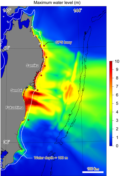
Numerical modeling of the 2011 Tohoku-oki earthquake tsunami (highest water level up to 3 hours after the earthquake). The modeling shows how a huge tsunami struck the coast of Iwate, Miyagi and Fukushima prefectures
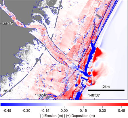
Numerical modeling of sediment transport by the Tohoku-oki earthquake tsunami, showing simulated morphological change at the mouth of the Natori River (Sendai to Natori Cities, Miyagi Prefecture). The results show that the sandy beach was heavily eroded and the sand was deposited inland.
Understanding earthquake occurrence mechanisms and seismotectonics through InSAR and modeling
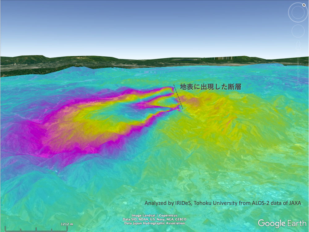 Landform changes that occur between different times can be extracted using Interferometric Synthetic Aperture Radar (InSAR) data and Global Navigation Satellite System (GNSS) data, if available. We analyze these changes together with the results of detailed fault field surveys to study earthquake occurrence mechanisms. We also study hazard assessment methods for inland earthquakes using crustal deformation data as well as landslides and subsidence observable by InSAR.